StarFire209 (talk | contribs) (how could you forget Iowa?) |
mNo edit summary |
||
| Line 1: | Line 1: | ||
| − | [[Image:Miri's North America on screen.jpg|thumb| |
+ | [[Image:Miri's North America on screen.jpg|thumb|A continent resembling North America on a [[viewscreen]]]] |
[[Image:Cage-screen-16-Northern-Hemisphere.jpg|thumb|20th century map depicting North America next to the Arctic Circle.]] |
[[Image:Cage-screen-16-Northern-Hemisphere.jpg|thumb|20th century map depicting North America next to the Arctic Circle.]] |
||
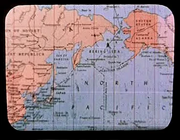
[[Image:Earth map, 20th century, North Pacific.jpg|thumb|20th century map depicting the northern Pacific region.]] |
[[Image:Earth map, 20th century, North Pacific.jpg|thumb|20th century map depicting the northern Pacific region.]] |
||
Revision as of 03:23, 29 September 2007
A continent resembling North America on a viewscreen
20th century map depicting North America next to the Arctic Circle.
20th century map depicting the northern Pacific region.
North America is a continent on Earth and, along with neighboring South America, was the ancestral home of the Native American human tribes. The nation-states of Canada, Mexico, and the United States of America were located on the North American continent.
20th century-era maps of the northern hemisphere were stored in the USS Enterprise library computer in 2254. One map depicted Alaska on the Pacific Ocean coast of North America. Another map depicted North America from the point of view of the Arctic Circle, showing the same region. These maps were among the materials viewed by the Talosians when they scanned the Enterprise computer. (TOS: "The Cage")
North America is home to the regions Alaska, Baja, Florida, Idaho, Iowa, Manitoba, Montana, New York, Ohio, Rhode Island, South Carolina, and Virginia, as well as to the following cities and towns:
- Atlanta
- Bloomington
- Boston
- Bozeman
- Broken Bow
- Calgary
- Carbon Creek
- Chicago
- Detroit
- Duluth
- Indianapolis
- Kansas City
- Los Angeles
- Mojave
- New Orleans
- New York City
- Oakland
- Phoenix
- Roswell
- San Francisco
- Sausalito
- Secaucus
- Topeka
- Toronto
| Continents of Earth |
|---|
| Africa • Antarctica • Asia • Australia • Europe • North America • South America |