m (Undo revision 905080 by 4.245.79.94 (talk) nice geography homework, but what's canon is already here.) |
m (lk fixes) |
||
| (17 intermediate revisions by 13 users not shown) | |||
| Line 1: | Line 1: | ||
| − | [[ |
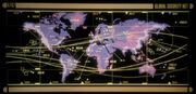
+ | [[File:Earth map.jpg|thumb|North America (upper left) in relation to five of Earth's seven continents]] |
| − | '''North America''' |
+ | '''North America''' was a continent on [[Earth]] and, along with neighboring [[South America]], was the ancestral home of the [[Native American]] [[Human]] tribes. The [[nation-states]] of [[Canada]], [[Mexico]], and the [[United States of America]] were located on the North American continent. |
| + | |||
| + | North America was depicted in many [[assignment patch|mission insignias]] of [[NASA]]'s space programs, especially for the [[Apollo program]] and [[Space shuttle]] program, in the 20th and 21st centuries. Some of these insignias survived into the 22nd century where they were displayed in the [[602 Club]]. ({{ENT|First Flight}}) |
||
[[20th century]]-era maps of the northern hemisphere were stored in the {{USS|Enterprise|NCC-1701}} [[library computer]] in [[2254]]. One map depicted [[Alaska]] on the [[Pacific Ocean]] coast of North America. Another map depicted North America from the point of view of the [[Arctic Circle]], showing the same region. These maps were among the materials viewed by the [[Talosian]]s when they scanned the ''Enterprise'' computer. ({{TOS|The Cage}}) |
[[20th century]]-era maps of the northern hemisphere were stored in the {{USS|Enterprise|NCC-1701}} [[library computer]] in [[2254]]. One map depicted [[Alaska]] on the [[Pacific Ocean]] coast of North America. Another map depicted North America from the point of view of the [[Arctic Circle]], showing the same region. These maps were among the materials viewed by the [[Talosian]]s when they scanned the ''Enterprise'' computer. ({{TOS|The Cage}}) |
||
<gallery> |
<gallery> |
||
| − | + | File:Earth map, 20th century, Northern Hemisphere.jpg|20th century map depicting North America next to the Arctic Circle |
|
| − | + | File:Earth map, 20th century, North Pacific.jpg|20th century map depicting the northern Pacific region |
|
| − | + | File:Miri's North America on screen, remastered.jpg|A continent resembling North America on a [[Miri's homeworld]] |
|
</gallery> |
</gallery> |
||
| Line 26: | Line 28: | ||
=== Mexico === |
=== Mexico === |
||
| + | * [[Cancún]] |
||
* [[Acapulco]] |
* [[Acapulco]] |
||
=== United States === |
=== United States === |
||
| + | {| style="width:100%; background: transparent;" |
||
| − | {{USCities}} |
||
| + | |- valign="top" |
||
| + | | |
||
| + | *[[Alameda]] |
||
| + | *[[Albany, California|Albany, CA]] |
||
| + | *[[Albany, New York|Albany, NY]] |
||
| + | *[[Anchorage]] |
||
| + | *[[Asheville]] |
||
| + | *[[Atlanta]] |
||
| + | *[[Barstow, California|Barstow]] |
||
| + | *[[Belmont]] |
||
| + | *[[Berkeley, California|Berkeley]] |
||
| + | *[[Bloomington]] |
||
| + | *[[Boise]] |
||
| + | *[[Boston]] |
||
| + | *[[Bozeman]] |
||
| + | *[[Broken Bow]] |
||
| + | *[[Cambridge]] |
||
| + | *[[Camden City]] |
||
| + | *[[Canton]] |
||
| + | *[[Carbon Creek]] |
||
| + | *[[Chicago]] |
||
| + | *[[Cleveland]] |
||
| + | *[[Cooperstown]] |
||
| + | *[[Daly City]] |
||
| + | | |
||
| + | *[[Deadwood]] |
||
| + | *[[Decatur]] |
||
| + | *[[Detroit]] |
||
| + | *[[Dodge City]] |
||
| + | *[[Doylestown]] |
||
| + | *[[Duluth]] |
||
| + | *[[El Cerrito]] |
||
| + | *[[Fairbanks]] |
||
| + | *[[Gettysburg]] |
||
| + | *[[Honolulu]] |
||
| + | *[[Houston]] |
||
| + | *[[Indianapolis]] |
||
| + | *[[Juneau]] |
||
| + | *[[Kansas City]] |
||
| + | *[[Kensington]] |
||
| + | *[[Kitty Hawk]] |
||
| + | *[[Las Vegas]] |
||
| + | *[[Lee's Summit]] |
||
| + | *[[Los Angeles]] |
||
| + | *[[Lubbock]] |
||
| + | *[[Madison, Wisconsin|Madison]] |
||
| + | *[[Manzanar]] |
||
| + | | |
||
| + | *[[Miami]] |
||
| + | *[[Mill Valley]] |
||
| + | *[[Millbrae]] |
||
| + | *[[Mobile]] |
||
| + | *[[Mojave]] |
||
| + | *[[New Orleans]] |
||
| + | *[[New York City]] |
||
| + | *[[Nyack]] |
||
| + | *[[Oakland]] |
||
| + | *[[Oklahoma City]] |
||
| + | *[[Omaha]] |
||
| + | *[[Panama City]] |
||
| + | *[[Pensacola]] |
||
| + | *[[Philadelphia]] |
||
| + | *[[Phoenix, Arizona|Phoenix]] |
||
| + | *[[Piedmont]] |
||
| + | *[[Pine Mountain]] |
||
| + | *[[Pittsburgh]] |
||
| + | *[[Portage Creek]] |
||
| + | *[[Portland]] |
||
| + | *[[Quincy]] |
||
| + | *[[Rapid City]] |
||
| + | | |
||
| + | *[[Reno]] |
||
| + | *[[Richmond]] |
||
| + | *[[Riverside]] |
||
| + | *[[Roswell]] |
||
| + | *[[Salem]] |
||
| + | *[[San Antonio]] |
||
| + | *[[San Bruno]] |
||
| + | *[[San Diego]] |
||
| + | *[[San Francisco]] |
||
| + | *[[Santa Cruz]] |
||
| + | *[[Santa Monica]] |
||
| + | *[[Sausalito]] |
||
| + | *[[Scarsdale]] |
||
| + | *[[Seattle]] |
||
| + | *[[Secaucus]] |
||
| + | *[[St. Louis]] |
||
| + | *[[Saint Paul]] |
||
| + | *[[Tarpon Springs]] |
||
| + | *[[Tiburon, California|Tiburon]] |
||
| + | *[[Tombstone]] |
||
| + | *[[Topeka]] |
||
| + | *[[Washington, DC|Washington]] |
||
| + | |} |
||
| + | |||
| ⚫ | |||
== External link == |
== External link == |
||
* {{wikipedia}} |
* {{wikipedia}} |
||
| ⚫ | |||
| − | |||
| ⚫ | |||
[[de:Nordamerika]] |
[[de:Nordamerika]] |
||
| + | [[fr:Amérique du Nord]] |
||
| + | [[it:Nord America]] |
||
[[nl:Noord Amerika]] |
[[nl:Noord Amerika]] |
||
| ⚫ | |||
Revision as of 18:05, 23 May 2014
North America (upper left) in relation to five of Earth's seven continents
North America was a continent on Earth and, along with neighboring South America, was the ancestral home of the Native American Human tribes. The nation-states of Canada, Mexico, and the United States of America were located on the North American continent.
North America was depicted in many mission insignias of NASA's space programs, especially for the Apollo program and Space shuttle program, in the 20th and 21st centuries. Some of these insignias survived into the 22nd century where they were displayed in the 602 Club. (ENT: "First Flight")
20th century-era maps of the northern hemisphere were stored in the USS Enterprise library computer in 2254. One map depicted Alaska on the Pacific Ocean coast of North America. Another map depicted North America from the point of view of the Arctic Circle, showing the same region. These maps were among the materials viewed by the Talosians when they scanned the Enterprise computer. (TOS: "The Cage")
")
")
States and provinces
Canada
- Alberta
- Manitoba
Denmark
- Greenland
United States
| States and districts of the United States of America |
|---|
 |
Cities
Canada
- Calgary
- Toronto (Toronto City Hall)
Mexico
United States
| Continents of Earth |
|---|
| Africa • Antarctica • Asia • Australia • Europe • North America • South America |