Pseudohuman (talk | contribs) mNo edit summary |
m (Robot: Automated text replacement (-File:Star-chart_alpha-beta_quadrant.jpg +File:The Explored Galaxy.jpg)) |
||
| Line 8: | Line 8: | ||
{{clear}} |
{{clear}} |
||
== "The Explored Galaxy" == |
== "The Explored Galaxy" == |
||
| − | [[File: |
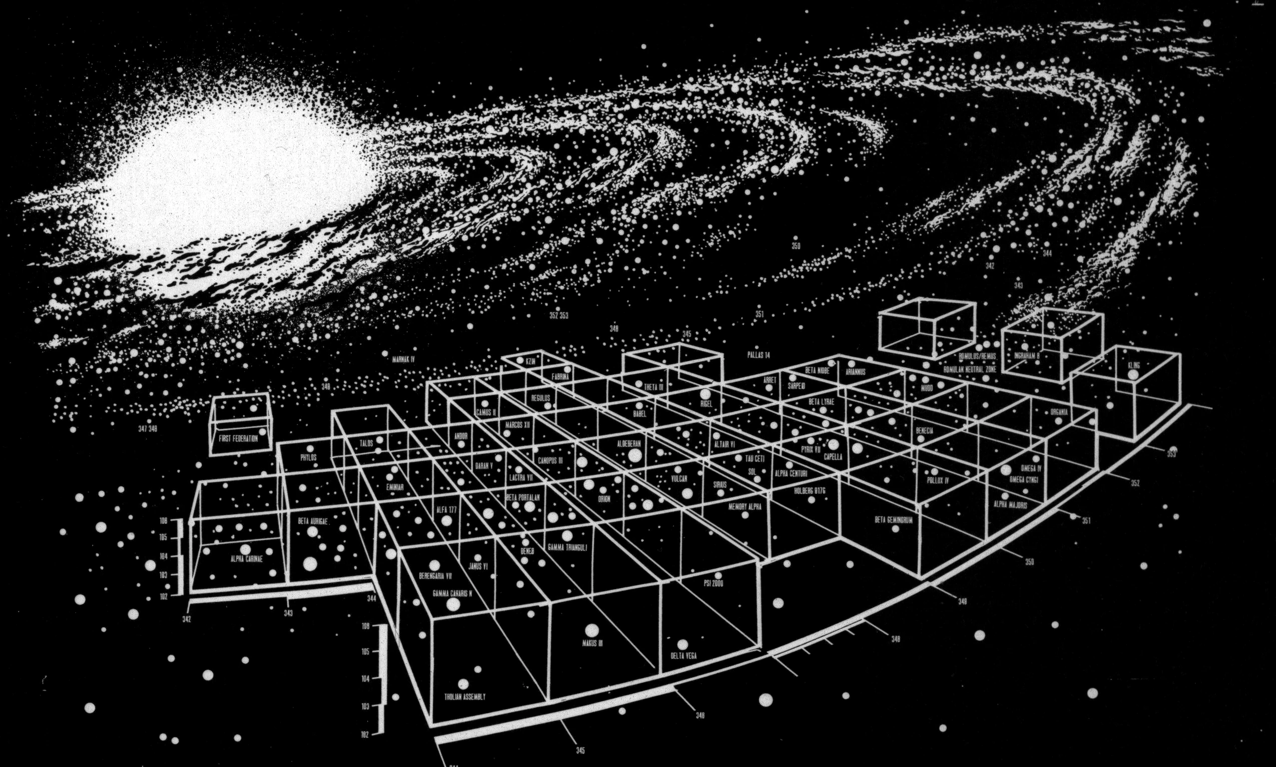
+ | [[File:The Explored Galaxy.jpg|thumb|A [[star chart]] of the explored areas of the [[Milky Way Galaxy]]]] |
The star chart of the explored space in the [[Alpha Quadrant]] depicted the home systems of the three great powers in the quadrant - the Federation, the [[Klingon Empire]], and the [[Romulan Star Empire]]. Along with these systems, the home systems of several less significant powers - the [[Tholian Assembly]], the [[First Federation]], and the [[Kzin]] - were, also, depicted on the chart. Many of the locations on this map were visited by the {{USS|Enterprise|NCC-1701}} during its historic five-year mission of the late [[2260s]]. Developments in the [[24th century]], such as the expansion of the great powers into uncharted and charted space, reduced this chart to a historical relic by the [[2370s]]. |
The star chart of the explored space in the [[Alpha Quadrant]] depicted the home systems of the three great powers in the quadrant - the Federation, the [[Klingon Empire]], and the [[Romulan Star Empire]]. Along with these systems, the home systems of several less significant powers - the [[Tholian Assembly]], the [[First Federation]], and the [[Kzin]] - were, also, depicted on the chart. Many of the locations on this map were visited by the {{USS|Enterprise|NCC-1701}} during its historic five-year mission of the late [[2260s]]. Developments in the [[24th century]], such as the expansion of the great powers into uncharted and charted space, reduced this chart to a historical relic by the [[2370s]]. |
||
Revision as of 18:25, 1 January 2013
A star chart of the Milky Way Galaxy
The Federation star charts were a collection of star charts, including all pertinent information about the star systems visited by Federation probes and starships.
In 2269, the USS Enterprise was on outward course beyond the fringe of the galaxy, near Questar M-17 on a star charting mission. (TAS: "Beyond the Farthest Star")
In 2370, the USS Enterprise-D investigated a rogue comet in Sector 1156 that was not on Federation charts. (TNG: "Masks")
"The Explored Galaxy"
A star chart of the explored areas of the Milky Way Galaxy
The star chart of the explored space in the Alpha Quadrant depicted the home systems of the three great powers in the quadrant - the Federation, the Klingon Empire, and the Romulan Star Empire. Along with these systems, the home systems of several less significant powers - the Tholian Assembly, the First Federation, and the Kzin - were, also, depicted on the chart. Many of the locations on this map were visited by the USS Enterprise during its historic five-year mission of the late 2260s. Developments in the 24th century, such as the expansion of the great powers into uncharted and charted space, reduced this chart to a historical relic by the 2370s.
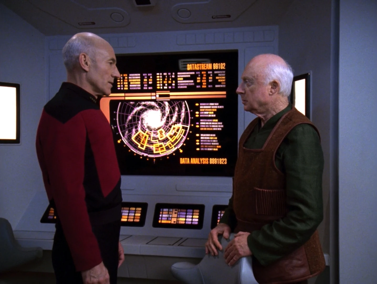
In 2293, the star chart of the explored galaxy was displayed in Captain Kirk's quarters aboard the USS Enterprise-A. (Star Trek VI: The Undiscovered Country) The chart was also seen frequently in the 24th century in various locations. In 2364, the chart was displayed at Starfleet Headquarters in the room where Dexter Remmick, possessed by neural parasites, was killed after sending a homing beacon. (TNG: "Conspiracy") In 2365, the chart was seen in the court room on Starbase 173 (TNG: "The Measure Of A Man") and the tactical room aboard the USS Enterprise-D, close to another map that depicted the whole Milky Way Galaxy. (TNG: "The Emissary") In 2367, the chart was seen in the tactical laboratory of Enterprise-D. (TNG: "The Mind's Eye") In 2368, in the ship's engineering laboratory. (TNG: "The Game") In 2369 and 2370, the chart was seen in the classroom aboard Deep Space 9, featuring the heading "The Explored Galaxy". (DS9: "In the Hands of the Prophets", "Cardassians")
LCARS star charts
Several star charts appeared in the USS Enterprise-D library computer.
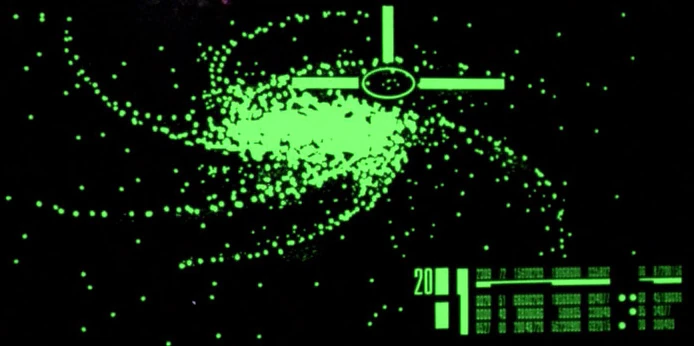
A galaxy
- Spiral galaxy
- This image shows an unnamed spiral galaxy.

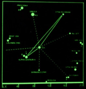
A star chart
- Star chart 1
- This star chart showed Sol located near the center of the map; the bold lines lead from there to Epsilon Eridani (upper right) and Alpha Centauri A (lower left). Thinner lines lead to other stars, like Sirius A, Tau Ceti, 61 Cygni A and Barnard's star. Other stars depicted are Wolf 359, Procyon A and B, Ross 248, Luyten 789-6, Epsilon Indi, Ross 154, Groombridge 34 A and B, Alpha Centauri B and C, Sirius B, 61 Cygni B and Lalande 21185.
A star chart
- Star chart 2
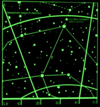
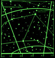
- This star chart showed text in the upper left corner stating that the transport Diana was plundered there. The text in the upper right corner marked the location where the USS Muleskinner was spacejacked.
A star chart
- Star chart 3
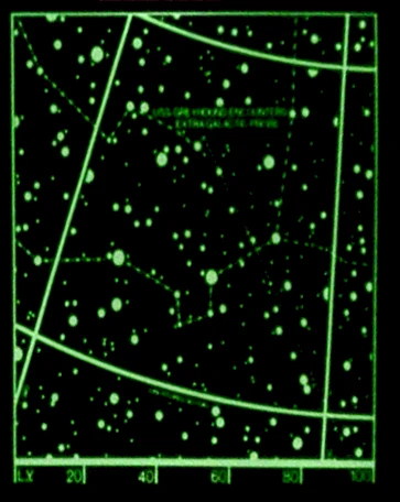
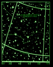
- This star chart showed text in the upper half of the chart denoting the place where the USS Greyhound encountered a probe from outside the galaxy.
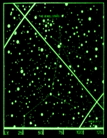
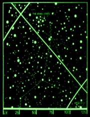
A star chart
- Star chart 4
- This star chart shows, in the upper half, the Jewel Stars. Argelius II is identified in the lower right corner of the star chart.

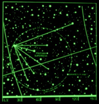
A star chart
- Star chart 5
- This star chart shows points around the supernova of the star Phi Puma, out towards Bayard's Planet, denoted by text in the lower right corner.
A star chart
- Star chart 6
- This image shows a star chart.
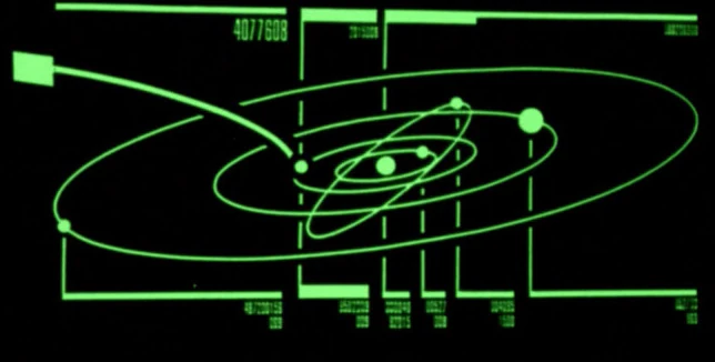
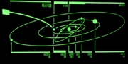
A planetary system
- Star system 1
- This image shows a planetary system consisting of five planets and one central star. The second planet in the system has an irregular orbit.

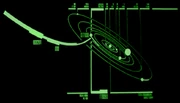
A planetary system
- Star system 2
- This image shows a planetary system consisting of seven planets and one central star.
A planetary system
- Star system 3
- This image shows a planetary system consisting of one central planet and six orbiting moons.
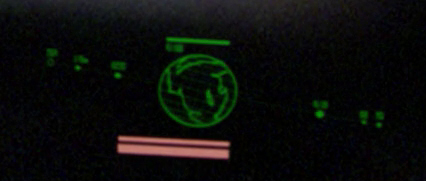
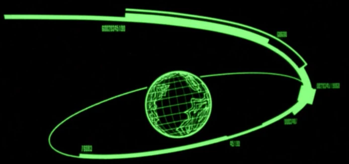
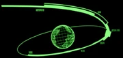
A planet
- Planet 1
- This image shows a planet with several continents. An orbit of the planet is displayed as well.

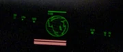
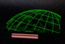
A part of a planet
- Planet 2
- This image shows parts of the northern hemisphere of a planet with several continents.