mNo edit summary |
m (lk fix) |
||
| (88 intermediate revisions by 15 users not shown) | |||
| Line 1: | Line 1: | ||
| − | '''Coordinates''', also called '''galactic coordinates''' or '''spatial coordinates''', are a set of numbers used to indicate a specific location on a [[planet]]'s surface or point in [[space]]. |
||
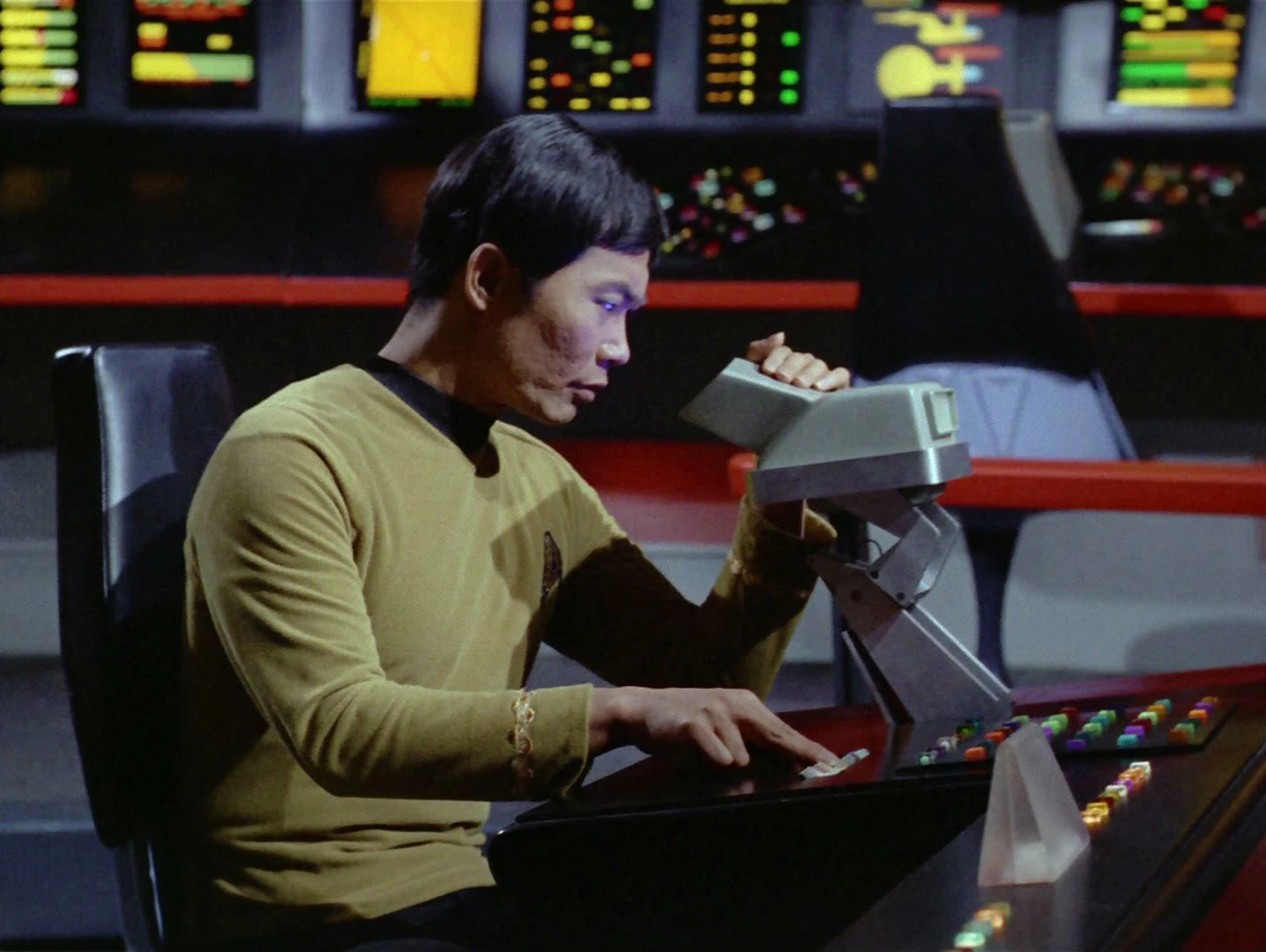
| + | [[File:Constitution helm console with viewer.jpg|thumb|Destination coordinates were laid in at the helm console]] |
||
| − | The [[star]] [[Azati Prime]] is located at coordinates '''1127.4 by 4052.0 by 3901.1'''. ({{ENT|Stratagem}}) |
||
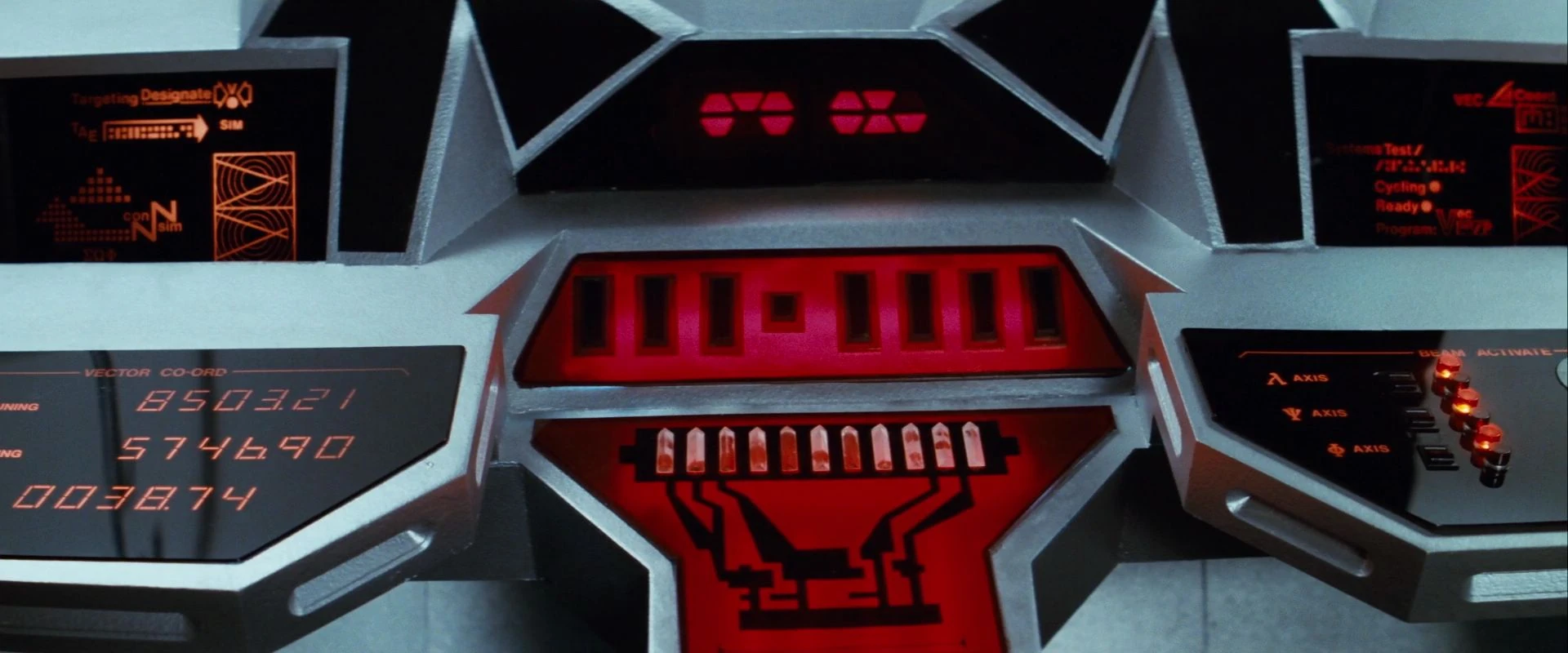
| + | [[File:Regula I transport console.jpg|thumb|Transporter coordinates on the transporter console]] |
||
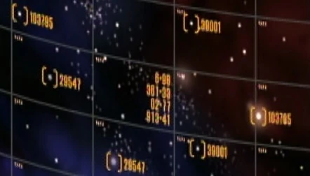
| + | [[File:Spatial grid with coordinates.jpg|thumb|Coordinates on a [[spatial grid]]]] |
||
| + | '''Coordinates''', also known as '''galactic coordinates''' or '''spatial coordinates''', were a set of two, three, or four numbers used to indicate the location of a [[star]], a [[planet]], an [[asteroid field]], or any other object or position in [[space]]. When setting a [[heading]] for a [[starship]], the course was laid in to the destination coordinates at the [[helm console]]. ({{ENT|Stratagem}}; {{VOY|Unity}}; {{film|12}}) |
||
| + | A set of coordinates was also used to indicate a specific location on a planet or a [[planetoid]]. Surface or underground coordinates were used as '''transporter coordinates''' when beaming up from or down to a planet with the [[transporter]]. A set from one to three numbers was used to determine a location. These coordinates could be automatically obtained by locking onto a [[communicator]] signal or by tying into the ship's [[sensor]]s. They could also be manually input into the [[transporter console]]. ({{TOS|A Piece of the Action|Day of the Dove|The Mark of Gideon}}) These coordinates were labeled as vector coordinates in the lambda, psi and phi axis on the transporter console. ({{film|2}}) |
||
| ⚫ | |||
| + | Following the crash of ''{{dis|Shuttlepod 1|2151}}'' beneath the [[surface]] of [[Terra Nova]], Captain Archer asked T'Pol to give him the coordinates the shuttlepod came to a stop. ({{ENT|Terra Nova}}) |
||
| − | [[Captain]] [[James T. Kirk]] broadcasted a distress call to [[Starfleet]] from coordinates '''000 mark 2''', when the {{USS|Enterprise|NCC-1701-A|-A}} was commandeered by [[Sybok]]. This location was on a heading from [[Nimbus III]] to the center of the galaxy, moments before the [[Great Barrier]] became visible from the windows of the ship. ({{film|5}}) |
||
| + | In [[June]] of [[2151]], [[Captain]] [[Jonathan Archer]] informed [[helmsman]] [[Travis Mayweather]] about a course correction and told him that [[Sub-commander]] [[T'Pol]] would give him the coordinates. ({{ENT|The Andorian Incident}}) |
||
| ⚫ | |||
| + | When [[Malcolm Reed]]'s [[assault team]] was ready to be beamed to the [[Vulcan]] [[monastery]] at [[P'Jem]], he asked [[Hoshi Sato]] if she had the coordinates set. ({{ENT|The Andorian Incident}}) |
||
| ⚫ | |||
| − | |||
| ⚫ | |||
| + | == Examples of galactic/spatial coordinates == |
||
| ⚫ | |||
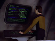
| + | [[File:Constellation class tactical station.jpg|thumb|Maxia Zeta system at coordinates 16453/452.45]] |
||
| + | * '''000-mark-2''': A location of space between [[Nimbus III]] and the center of the [[Milky Way Galaxy]], before the [[Great Barrier]] becomes visible to the naked eye. [[Captain]] [[James T. Kirk]] sent a distress call to [[Starfleet]] from these coordinates in [[2287]] when the {{USS|Enterprise|NCC-1701-A|-A}} was commandeered by [[Sybok]]. ({{film|5}}) |
||
| ⚫ | |||
| − | On [[stardate]] 49123.5621, ''Voyager'' was at spatial coordinates '''21 alpha prime by 936 zeta.''' ({{VOY|Relativity}}) |
||
| + | * '''003-1040808, 1230 003-111309.3''' (Grid 07 Quad 09 block 3 sector 1): The location of the planet [[Xahea]] ({{DIS|Such Sweet Sorrow}}) |
||
| − | [[Kes]] once contacted a [[Vidiian starship (2371-2372)|Vidiian starship]] located at coordinates '''206.80 by 102.8 by 128.59'''. ({{VOY|Fury}}) |
||
| + | * '''005-mark-317''': The coordinates of asteroids inside the [[asteroid field]] where the {{USS|Enterprise|NCC-1701-D|-D}} tested new [[photon torpedo]]es in [[2370]]. ({{TNG|Genesis}}) |
||
| ⚫ | |||
| + | |||
| − | * [[Galactic plane]] |
||
| ⚫ | |||
| + | |||
| ⚫ | * '''18-mark-205-mark-47''': The location of the {{USS|Voyager}} in the [[Delta Quadrant]] in [[2374]]. Upon discovering the [[Hirogen communications network]] which enabled ''Voyager''{{'}}s first contact with Starfleet in years, Captain [[Kathryn Janeway]] stated the ship's coordinates. ({{VOY|Message in a Bottle}}) |
||
| + | |||
| + | * '''21 alpha prime/936 zeta''': The spatial coordinates of the USS ''Voyager'' in the Delta Quadrant in [[2372]] on [[stardate]] 49123.5621. ({{VOY|Relativity}}) |
||
| + | |||
| + | * '''22/87/4''': The coordinates of [[Gamma Hydra]] Section 14 on the [[Federation]] side of the [[Neutral zone]] in [[2285]]. ({{film|2}}) |
||
| + | |||
| + | * '''23.17.46.11''': The coordinates of the [[Io Facility]] that was in the [[alternate reality]] [[orbit]]ing [[Io]] a [[moon]] of the planet [[Jupiter]] in the [[Sol system]]. ({{film|12}}) |
||
| + | |||
| + | * '''2345.9033''': ({{ST|Runaway}}) |
||
| + | {{bginfo|The episode implies but not outright states these transporter coordinates to correspond to [[Xahea]], as Tilly inserts them after deciding to send [[Me Hani Ika Hali Ka Po]] home. However, the ship is not shown to be at that planet, which would be necessary for the transporter to bridge that distance (without [[transwarp beaming]]). The issue is further complicated in that Tilly appeared to be working alone, precluding the possibility that Po was transported to a nearby transport.}} |
||
| + | |||
| ⚫ | |||
| + | |||
| + | * '''43.89.26.05''': The coordinates of the planet [[Qo'noS]] in [[grid 09]], [[quad 68]], [[block 27]], [[sector 70]]. ({{film|12}}) |
||
| + | |||
| + | * '''070-mark-3''': The coordinates of [[quadrant 9]] inside the Neutral Zone. A battle between the commandeered ''[[Batris]]'' and the {{IKS|T'Acog}} took place there in 2364. ({{TNG|Heart of Glory}}) |
||
| + | |||
| + | * '''070-mark-63''': The position in space where [[Q]] returned the USS ''Enterprise''-D in [[2365]] after [[first contact]] with the [[Borg]]. ({{TNG|Q Who}}) |
||
| + | |||
| + | * '''81-mark-40''': Coordinates of a [[Kazon-Nistrim]] [[Kazon raider|raider]] using [[masking circuitry]] encountered by USS ''Voyager'' in the Delta Quadrant in [[2371]]. ({{VOY|State of Flux}}) |
||
| + | |||
| + | * '''090-mark-345''': The location of [[Starbase 179]]. ({{TNG|A Matter Of Honor}}) |
||
| + | |||
| + | * '''113-mark-7''': The coordinates of an asteroid field in the [[Nekrit Expanse]] in the Delta Quadrant. ({{VOY|Unity}}) |
||
| + | |||
| + | * '''121-mark-6''': A location inside [[Sector 38]] in the Delta Quadrant near [[Tak Tak]] space. USS ''Voyager'' was found adrift at these coordinates in [[2373]] after the crew had been infected by a [[macrovirus]]. ({{VOY|Macrocosm}}) |
||
| + | |||
| + | * '''140/205''': A location of space just outside the [[Romulan Neutral Zone]] in Federation space, where the USS ''Enterprise''-D intercepted a [[Romulan scoutship]] in [[2366]]. ({{TNG|The Defector}}) |
||
| + | |||
| + | * '''140-mark-317''': A location of space in the Delta Quadrant. A [[Kazon]] buoy dropped at these coordinates was used by [[Seska]] to relay a communication to the USS ''Voyager'' in 2372. ({{VOY|Basics, Part I}}) |
||
| + | |||
| + | * '''158-mark-13''': Coordinates of [[Unnamed Alpha and Beta Quadrant planets#Suliban gas giant|a gas giant]] used by the [[Suliban]] to hide a [[Suliban helix|helix]] in [[2151]]. More specifically these were coordinates near the helix inside the atmosphere of the gas giant. ({{ENT|Broken Bow}}) |
||
| + | |||
| + | * '''171-mark-43''': Coordinates of the nearest [[plasma storm]] in the [[Badlands]] to the [[Maquis raider]] ''[[Val Jean]]'' during their escape from the {{class|Galor}} [[Cardassian]] [[starship]] ''[[Vetar]]''. ({{VOY|Caretaker}}) |
||
| + | |||
| + | * '''206.80/102.8/128.59''': The location of a [[Vidiian ship (2371-2372)|Vidiian ship]] in the Delta Quadrant in 2371 that was contacted by [[Kes]]. ({{VOY|Fury}}) |
||
| + | |||
| + | * '''207-mark-99''': The coordinates of [[Deep Space 9]]. ({{DS9|A Time to Stand}}, ''display graphic'') |
||
| + | |||
| + | * '''211-mark-61''': A location of space inside the remains of the planet [[Orelious IX]], where the USS ''Enterprise''-D discovered a [[Promellian battlecruiser]] in 2366. ({{TNG|Booby Trap}}) |
||
| + | |||
| + | * '''227-mark-359''': Coordinates of the planet [[Iconia]], inside the Romulan Neutral Zone. ({{TNG|Contagion}}) |
||
| + | |||
| + | * '''237.101''': A location of space near the planet [[Vagra II]]. After experiencing an on board systems failure, the drifting [[Enterprise-D shuttlecraft 13|shuttlecraft 13]] of the USS ''Enterprise''-D was caught in the planet's gravity at these coordinates and crash landed in 2364. ({{TNG|Skin Of Evil}}) |
||
| + | |||
| + | * '''254-mark-220''': The coordinates of the [[Dominion]] [[Ketracel-white]] facility in [[Cardassian]] space destroyed during the [[Dominion War]] in [[2374]]. ({{DS9|A Time to Stand}}, ''display graphic'') |
||
| + | |||
| + | * '''314-mark-21''': Coordinates of a small [[Kazon raider]] in the Delta Quadrant moments before it attacked the USS ''Voyager'' in 2372. ({{VOY|Basics, Part I}}) |
||
| + | |||
| + | * '''357-mark-220''': The coordinates of the planet [[Cardassia]]. ({{DS9|A Time to Stand}}, ''display graphic'') |
||
| + | |||
| + | * '''370.236''': A location of space in the [[Zed Lapis sector]]. Shuttlecraft 13 experienced an on board systems failure at these coordinates in 2364. ({{TNG|Skin Of Evil}}) |
||
| + | |||
| + | * '''404.119.381''': coordinates of [[Kaminar]]. ({{DIS|The Sound of Thunder}}) |
||
| + | {{bginfo|These numbers were seen both without context on a graphic depicting the planet in its system, and later as transporter coordinates given by Saru to beam down.}} |
||
| + | |||
| + | * '''423/112/51''': Coordinates of a location near but outside the [[Boradis system]], in a sector colonized by the Federation. The USS ''Enterprise''-D intercepted the [[class 8 probe]] carrying [[special emissary]] [[K'Ehleyr]] there in 2365. ({{TNG|The Emissary}}) |
||
| + | |||
| + | * '''7-4-9 Mark 1-4-8''': [[Talos IV]] ({{DIS|Light and Shadows}}) |
||
| + | |||
| + | * '''1127.4/4052.0/3901.1''': The location of [[Unnamed Alpha and Beta Quadrant stars#Red giant|the star]] near [[Azati Prime]]. ({{ENT|Stratagem}}) |
||
| + | |||
| ⚫ | |||
| + | |||
| + | * '''4159.26/81921/312''': A location of space between the planet [[Tarsas III]] in [[Sector 001]] and the planet [[Bynaus]]. ({{TNG|11001001|Conspiracy}}, ''display graphic'') |
||
| + | |||
| + | * '''16453/452.45''': The navigational coordinates of the [[Maxia Zeta system]]. ({{TNG|The Battle}}, ''display graphic'') |
||
| + | |||
| + | * '''48563.3/99340.4/00596.3''': The coordinates of [[Tanuga IV research station|a research station]] orbiting the planet [[Tanuga IV]] before it's destruction in [[2366]]. ({{TNG|A Matter of Perspective}}, ''display graphic'') |
||
| + | |||
| + | * '''66728.9/707542.2''': The coordinates of the [[Pegos Minor system]]. ({{TNG|We'll Always Have Paris}}) |
||
| + | |||
| + | * ''' 7-4 Mark 5.6''': [[Section 31 Headquarters]] ({{DIS|Project Daedalus}}) |
||
| + | |||
| + | * '''917358-358268-102879''': The coordinates of the Amargosa observatory. ({{film|7}}) |
||
| + | |||
| + | * '''81968 mark 272139''': The precise coordinates where contact was lost with the {{USS|Yelchin|NCC-4774-E}} in [[3069]]. ({{DIS|Unification III}}) |
||
| + | |||
| + | == Examples of surface/underground coordinates == |
||
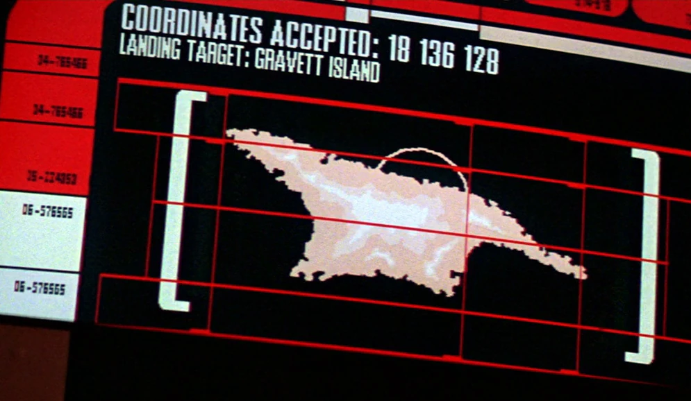
| + | [[File:Gravett Island, map.jpg|thumb|Gravett Island at coordinates 18/136/128]] |
||
| + | * '''18/136/128''': The coordinates of [[Gravett Island]] on [[Earth]]. ({{film|8}}) |
||
| + | |||
| + | * '''118/220''': The surface coordinates near a [[village]] on the planet [[Gamma Trianguli VI]]. ({{TOS|The Apple}}) |
||
| + | |||
| + | * '''857/020/079''': The coordinates of the [[transporter room]] on the [[USS Enterprise (replica)|replica USS ''Enterprise'']] built on the planet [[Gideon]]. ({{TOS|The Mark of Gideon}}) |
||
| + | |||
| + | * '''857/020/709''': The coordinates of the chambers of the [[Gideon Council]] on the planet Gideon. ({{TOS|The Mark of Gideon}}) |
||
| + | |||
| + | * '''3517/2598''': The coordinates of a street in [[San Francisco]] close to [[Starfleet Headquarters]] on Earth. ({{film|12}}) |
||
| + | |||
| + | * '''8503.21/5746.90/0038.74''': The vector coordinates of the underground [[Genesis cave]] on the [[Regula]] planetoid. ({{film|2}}) |
||
| + | |||
| + | * '''8563''': Surface coordinates at the edge of the scanning range of [[Paradise City]] on [[Nimbus III]]. ({{film|5}}) |
||
| + | |||
| + | * '''010600, 011070''': Surface coordinates on [[Kolarus III]] where [[Shinzon]] left the disassembled [[B-4]] in [[2379]]. ({{film|10}}) |
||
| + | |||
| + | * '''Tau eight point seven. Beta point zero four one.''': Weakest point of an asteroid. ({{TOS|The Paradise Syndrome}}) |
||
| + | |||
| + | == Appendices == |
||
| ⚫ | |||
| + | * [[Bearing]] |
||
| + | * [[Borg spatial designations|Grid]] |
||
* [[Heading]] |
* [[Heading]] |
||
| + | * [[Navigation]] |
||
| + | * [[Quadrant]] |
||
| + | * [[Sector]] |
||
| + | |||
| + | === Background information === |
||
| + | According to ''[[Star Trek: The Next Generation Technical Manual]]'', (p. 36) spatial coordinates are used to establish a standard galactic X, Y, and Z position. |
||
| + | According to ''[[Star Trek Maps]]'', the XYZ spatial coordinates 0,0,0 used by the Federation are those of a central navigation beacon located near the core worlds of the Federation. The galactic XYZ values are in a grid in relation to this central beacon. Units in the grid are [[parsec]]s. The first value, X, is the distance towards (positive) or away from (negative) the center of the galaxy. The second value, Y, is the distance towards the left "[[Alpha Quadrant]]" direction (positive) or the right "[[Beta Quadrant]]" direction (negative). The third value, Z, is the distance in the galactic north direction upwards (positive) or galactic south downwards (negative) away from the [[galactic plane]]. Based on the various canon references, the system of coordinates used in ''Star Trek'' appears to be more complex than this. |
||
[[de:Koordinaten]] |
[[de:Koordinaten]] |
||
[[Category:Cartography]] |
[[Category:Cartography]] |
||
| + | [[Category:Transporter technology]] |
||
Latest revision as of 01:43, 26 October 2022
Destination coordinates were laid in at the helm console
Transporter coordinates on the transporter console
Coordinates on a spatial grid
Coordinates, also known as galactic coordinates or spatial coordinates, were a set of two, three, or four numbers used to indicate the location of a star, a planet, an asteroid field, or any other object or position in space. When setting a heading for a starship, the course was laid in to the destination coordinates at the helm console. (ENT: "Stratagem"; VOY: "Unity"; Star Trek Into Darkness)
A set of coordinates was also used to indicate a specific location on a planet or a planetoid. Surface or underground coordinates were used as transporter coordinates when beaming up from or down to a planet with the transporter. A set from one to three numbers was used to determine a location. These coordinates could be automatically obtained by locking onto a communicator signal or by tying into the ship's sensors. They could also be manually input into the transporter console. (TOS: "A Piece of the Action", "Day of the Dove", "The Mark of Gideon") These coordinates were labeled as vector coordinates in the lambda, psi and phi axis on the transporter console. (Star Trek II: The Wrath of Khan)
Following the crash of Shuttlepod 1 beneath the surface of Terra Nova, Captain Archer asked T'Pol to give him the coordinates the shuttlepod came to a stop. (ENT: "Terra Nova")
In June of 2151, Captain Jonathan Archer informed helmsman Travis Mayweather about a course correction and told him that Sub-commander T'Pol would give him the coordinates. (ENT: "The Andorian Incident")
When Malcolm Reed's assault team was ready to be beamed to the Vulcan monastery at P'Jem, he asked Hoshi Sato if she had the coordinates set. (ENT: "The Andorian Incident")
Examples of galactic/spatial coordinates

Maxia Zeta system at coordinates 16453/452.45
- 000-mark-2: A location of space between Nimbus III and the center of the Milky Way Galaxy, before the Great Barrier becomes visible to the naked eye. Captain James T. Kirk sent a distress call to Starfleet from these coordinates in 2287 when the USS Enterprise-A was commandeered by Sybok. (Star Trek V: The Final Frontier)
- 002/3845: The location of space where the USS James Fennimore Cooper and USS Robert Louis Stevenson rendezvoused with the USS Discovery in 2364. Both ships transported personnel from Starbase 55 to the Discovery. (TNG: "Conspiracy")
- 003-1040808, 1230 003-111309.3 (Grid 07 Quad 09 block 3 sector 1): The location of the planet Xahea (DIS: "Such Sweet Sorrow")
- 005-mark-317: The coordinates of asteroids inside the asteroid field where the USS Enterprise-D tested new photon torpedoes in 2370. (TNG: "Genesis")
- 0009-358070690 0009-407764209: The galactic coordinates the Tkon Empire. In 2364, Data presented a hologram of the Empire that included the coordinates. (TNG: "The Last Outpost")
- 18-mark-205-mark-47: The location of the USS Voyager in the Delta Quadrant in 2374. Upon discovering the Hirogen communications network which enabled Voyager's first contact with Starfleet in years, Captain Kathryn Janeway stated the ship's coordinates. (VOY: "Message in a Bottle")
- 21 alpha prime/936 zeta: The spatial coordinates of the USS Voyager in the Delta Quadrant in 2372 on stardate 49123.5621. (VOY: "Relativity")
- 22/87/4: The coordinates of Gamma Hydra Section 14 on the Federation side of the Neutral zone in 2285. (Star Trek II: The Wrath of Khan)
- 23.17.46.11: The coordinates of the Io Facility that was in the alternate reality orbiting Io a moon of the planet Jupiter in the Sol system. (Star Trek Into Darkness)
- 036.231: The galactic coordinates for the heart of the Milky Way Galaxy. After the magnetic organism overtook the USS Enterprise in 2269, it demanded that the crew set the ship on course to these specific coordinates. (TAS: "Beyond the Farthest Star")
- 43.89.26.05: The coordinates of the planet Qo'noS in grid 09, quad 68, block 27, sector 70. (Star Trek Into Darkness)
- 070-mark-3: The coordinates of quadrant 9 inside the Neutral Zone. A battle between the commandeered Batris and the IKS T'Acog took place there in 2364. (TNG: "Heart of Glory")
- 070-mark-63: The position in space where Q returned the USS Enterprise-D in 2365 after first contact with the Borg. (TNG: "Q Who")
- 81-mark-40: Coordinates of a Kazon-Nistrim raider using masking circuitry encountered by USS Voyager in the Delta Quadrant in 2371. (VOY: "State of Flux")
- 090-mark-345: The location of Starbase 179. (TNG: "A Matter Of Honor")
- 113-mark-7: The coordinates of an asteroid field in the Nekrit Expanse in the Delta Quadrant. (VOY: "Unity")
- 121-mark-6: A location inside Sector 38 in the Delta Quadrant near Tak Tak space. USS Voyager was found adrift at these coordinates in 2373 after the crew had been infected by a macrovirus. (VOY: "Macrocosm")
- 140/205: A location of space just outside the Romulan Neutral Zone in Federation space, where the USS Enterprise-D intercepted a Romulan scoutship in 2366. (TNG: "The Defector")
- 140-mark-317: A location of space in the Delta Quadrant. A Kazon buoy dropped at these coordinates was used by Seska to relay a communication to the USS Voyager in 2372. (VOY: "Basics, Part I")
- 158-mark-13: Coordinates of a gas giant used by the Suliban to hide a helix in 2151. More specifically these were coordinates near the helix inside the atmosphere of the gas giant. (ENT: "Broken Bow")
- 171-mark-43: Coordinates of the nearest plasma storm in the Badlands to the Maquis raider Val Jean during their escape from the Galor-class Cardassian starship Vetar. (VOY: "Caretaker")
- 206.80/102.8/128.59: The location of a Vidiian ship in the Delta Quadrant in 2371 that was contacted by Kes. (VOY: "Fury")
- 207-mark-99: The coordinates of Deep Space 9. (DS9: "A Time to Stand", display graphic)
- 211-mark-61: A location of space inside the remains of the planet Orelious IX, where the USS Enterprise-D discovered a Promellian battlecruiser in 2366. (TNG: "Booby Trap")
- 237.101: A location of space near the planet Vagra II. After experiencing an on board systems failure, the drifting shuttlecraft 13 of the USS Enterprise-D was caught in the planet's gravity at these coordinates and crash landed in 2364. (TNG: "Skin Of Evil")
- 254-mark-220: The coordinates of the Dominion Ketracel-white facility in Cardassian space destroyed during the Dominion War in 2374. (DS9: "A Time to Stand", display graphic)
- 314-mark-21: Coordinates of a small Kazon raider in the Delta Quadrant moments before it attacked the USS Voyager in 2372. (VOY: "Basics, Part I")
- 357-mark-220: The coordinates of the planet Cardassia. (DS9: "A Time to Stand", display graphic)
- 370.236: A location of space in the Zed Lapis sector. Shuttlecraft 13 experienced an on board systems failure at these coordinates in 2364. (TNG: "Skin Of Evil")
- 404.119.381: coordinates of Kaminar. (DIS: "The Sound of Thunder")
- 423/112/51: Coordinates of a location near but outside the Boradis system, in a sector colonized by the Federation. The USS Enterprise-D intercepted the class 8 probe carrying special emissary K'Ehleyr there in 2365. (TNG: "The Emissary")
- 7-4-9 Mark 1-4-8: Talos IV (DIS: "Light and Shadows")
- 1127.4/4052.0/3901.1: The location of the star near Azati Prime. (ENT: "Stratagem")
- 3629-mark-584: The location in space, where the USS Enterprise-D had a scheduled rendezvous with the USS Victory in 2365. (TNG: "Elementary, Dear Data")
- 4159.26/81921/312: A location of space between the planet Tarsas III in Sector 001 and the planet Bynaus. (TNG: "11001001", "Conspiracy", display graphic)
- 16453/452.45: The navigational coordinates of the Maxia Zeta system. (TNG: "The Battle", display graphic)
- 48563.3/99340.4/00596.3: The coordinates of a research station orbiting the planet Tanuga IV before it's destruction in 2366. (TNG: "A Matter of Perspective", display graphic)
- 66728.9/707542.2: The coordinates of the Pegos Minor system. (TNG: "We'll Always Have Paris")
- 7-4 Mark 5.6: Section 31 Headquarters (DIS: "Project Daedalus")
- 917358-358268-102879: The coordinates of the Amargosa observatory. (Star Trek Generations)
- 81968 mark 272139: The precise coordinates where contact was lost with the USS Yelchin in 3069. (DIS: "Unification III")
Examples of surface/underground coordinates
Gravett Island at coordinates 18/136/128
- 18/136/128: The coordinates of Gravett Island on Earth. (Star Trek: First Contact)
- 118/220: The surface coordinates near a village on the planet Gamma Trianguli VI. (TOS: "The Apple")
- 857/020/079: The coordinates of the transporter room on the replica USS Enterprise built on the planet Gideon. (TOS: "The Mark of Gideon")
- 857/020/709: The coordinates of the chambers of the Gideon Council on the planet Gideon. (TOS: "The Mark of Gideon")
- 3517/2598: The coordinates of a street in San Francisco close to Starfleet Headquarters on Earth. (Star Trek Into Darkness)
- 8503.21/5746.90/0038.74: The vector coordinates of the underground Genesis cave on the Regula planetoid. (Star Trek II: The Wrath of Khan)
- 8563: Surface coordinates at the edge of the scanning range of Paradise City on Nimbus III. (Star Trek V: The Final Frontier)
- 010600, 011070: Surface coordinates on Kolarus III where Shinzon left the disassembled B-4 in 2379. (Star Trek Nemesis)
- Tau eight point seven. Beta point zero four one.: Weakest point of an asteroid. (TOS: "The Paradise Syndrome")
Appendices
See also
Background information
According to Star Trek: The Next Generation Technical Manual, (p. 36) spatial coordinates are used to establish a standard galactic X, Y, and Z position.
According to Star Trek Maps, the XYZ spatial coordinates 0,0,0 used by the Federation are those of a central navigation beacon located near the core worlds of the Federation. The galactic XYZ values are in a grid in relation to this central beacon. Units in the grid are parsecs. The first value, X, is the distance towards (positive) or away from (negative) the center of the galaxy. The second value, Y, is the distance towards the left "Alpha Quadrant" direction (positive) or the right "Beta Quadrant" direction (negative). The third value, Z, is the distance in the galactic north direction upwards (positive) or galactic south downwards (negative) away from the galactic plane. Based on the various canon references, the system of coordinates used in Star Trek appears to be more complex than this.